 On the first morning of our scenic cruising, we headed south to visit the southernmost point in the western hemisphere, Cape Horn. It was named by a Dutch sailor from the town of Hoorn, Netherlands. After retracing a portion of the Beagle Channel, we made for the last bit of land. These are pictures from the "ship tracker" which we can access on our TV screen.
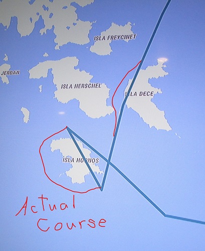
The first shows our route from Ushuaia to Cape Horn and back toward Ushuaia. The second shows what the ship tracker showed around Cape Horn. Since our ship is not capable of going overland, I added our actual route.

We circled the land counterclockwise so that, on the southern side where the winds are strongest, we had the prevalent westerly wind to our back instead of going into the wind. This is what we saw.
 |
| Cape Horn |

We then returned to the Beagle Channel and sailed right past Ushuaia and headed further west. By morning, the fog had lifted, the clouds went away and we had a glorious day of sailing.
Without further ado, here is some of what we saw.


 This shows our two day route from Ushuaia to Punta Arenas. I have no idea what the squiggle into the ocean on the left is all about, but the one above was was a detour down a fjord so we had even more beautiful mountains and glaciers to view.


No comments:
Post a Comment